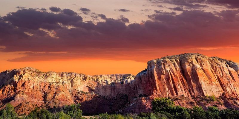
One of the most exhilarating ways to explore the northern New Mexican scenery is on foot. Within an hour of Taos are more than fifth hiking trails, mostly within the Carson National Forest, with others along the canyon of the Rio Grande River.
The fairly level West Rim Trail is easy to moderate, depending on the distance covered. It offers spectacular scenery including numerous views into the gorge with the winding river far below and mountains on all sides.
From the picnic area on Highway 64, west of the Rio Grande Gorge Bridge, you can hike out a mile or less and return for lunch; or you can continue for seventeen miles, taking six hours or more. The turnaround marker for the longer hike is N.M. Highway 567. This trail is best in fall, winter, or spring, as it can get pretty hot in summer.
Save the fairly easy Bull-of-the-Woods Meadow Trail for midsummer, when the meadow is full of wildflowers-a welcome reward for your effort! This two-mile walk is at a higher elevation (9,400 to 10,900 feet), making summer’s heat more bearable.
It begins at a parking lot on the left as you enter the village of Taos Ski Valley. Stay on the east side of the little stream, passing the more strenuous trail to Wheeler Peak on the right. Take a picnic lunch to enjoy in the meadow, surrounded by breathtaking scenery.
The four-mile round-trip Williams Lake Trail is popular in summer and fall because people of any age can hike it. It’s less crowded on a weekday morning. This hike takes about two and a half hours, but you’ll want additional time to explore the lakeshore.
From Taos Ski Valley follow signs to the Bavarian Restaurant. Hike past the restaurant to the chair lift, follow the road along a little stream and bear left at the fork. When the road becomes a trail, watch for signs to Williams Lake.
Another easy two-and-a-half-mile round-trip hike can be combined with fly-fishing! La Vista Verde Trail is reached from the village of Pilar, sixteen miles south of Taos. Take N.M. Highway 570, which crosses a bridge over the Rio Grande and ascends the other side of the canyon.
The parking lot and trailhead are easy to find. Although hikers find themselves well above the river, they can descend to it at the 0.6-mile marker to fish. A more challenging trail for fly-casters is the Big Arsenic Spring Loop in the Wild Rivers Recreation Area thirty-five miles north of Taos.
Two easy-to-moderate hikes take off from El Nogal Picnic Area, about 2.8 miles east of the junction of U.S. 64 (Kit Carson Road) and U.S. 68 in Taos. The six-mile Divisadero Peak Loop begins on the left side of 64 and the twenty-two-mile-long South Boundary Trail starts from the picnic area on the right side. Both climb through piñon and juniper forests, gaining 1,000 to 2,000 feet in elevation.
The most challenging hiking in Taos County is clustered around the Wheeler Peak Wilderness, an area accessible from either Taos Ski Valley or the town of Red River. From N.M. 150 (Ski Valley Road), hike the Yerba Canyon, Manzanita Canyon, Italianos Canyon, Gavilan, and Wheeler Peak trails.
The latter takes experienced hikers to the summit of the state’s highest peak (13,161 feet). From N.M. Highway 578, south of Red River, head for lovely lakes among evergreen trees via the Middle Fork Lake Trail, the moderate-to-strenuous Lost Lake Trail, and the strenuous Goose Lake/Gold Hill Trail.
Hiking always carries risks. Be sure you are comfortable at the 7,000-foot altitude in Taos before attempting to go higher. Always carry a backpack, sunscreen and lip protection, hats, a rain slicker, snacks, water, maps, and a compass. Also consider taking a first-aid kit, binoculars, a camera, a GPS system, insect repellent, a sweater, a pocketknife, and two-way radios, especially if your group is large and some members might become separated.
Wear sturdy hiking shoes that are well broken in and the right thickness of socks. If you experience dizziness, headaches, nausea, or shortness of breath, sit down, eat something, drink some water, and ask a companion to accompany you to a lower elevation. Do not leave any trail in search of a shortcut.
Helpful web sites include the following:
- AllTrails.com for trail information and topographic maps.
- Carson Forest website, which lists and rates trails within the Carson National Forest.
Santa Fe-Taos Hiking Guide by Bob D’Antonio (Westcliffe Publishers, 2004), is an excellent resource, as are maps published by the U.S. Geological Service and the Bureau of Land Management.


Leave a Reply